Glaciers around the world perform incredibly important roles in stabilising climate, providing a store of fresh water (which ends up being fed into the great river networks), and contributing to alpine ecology. Their melting is a massive problem globally in terms of climate stability as well as the ensuing impact regionally on agriculture, wildlife, river species etc … and locally for tourism.
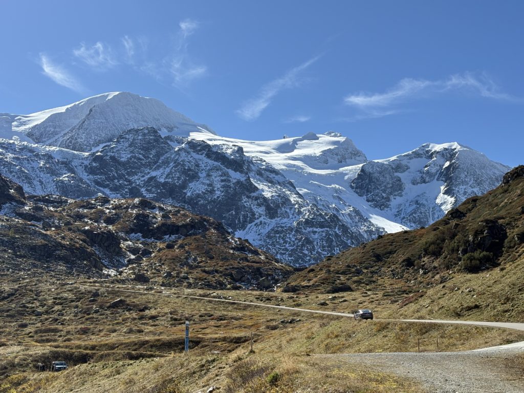
Since returning to live in Switzerland a few years ago, I’ve become deeply interested in the alpine regions. The contrast to my childhood environment couldn’t be starker: I grew up in the red dust of the Australian Outback. At first the attraction was the sheer beauty of the snow-capped alps and the precipitous cliffs that converged along chains of ridges to icy peaks. However, as my husband and I started to hike more regularly along alpine tracks (around 1,000 – 2,300m a.s.l.), I realised the alps were rapidly changing. There was less snow than I expected and summer temperatures were high for that altitude.
I recalled a conversation we’d had a few years previously during a lunch in the Bernese alps with a Swiss-Australian friend and his wife. It was the quintessentially perfect alpine day for which Switzerland is renowned: crystal clear blue skies, warm sun and towering snow-capped mountains. It was the type of day that is impossible to ruin. Or at least that’s what I thought until our friend told us that the glacier opposite that I had been marvelling at used to run almost to the valley floor when he was a boy. I struggled to understand how such a massive body of ice could have retreated so much in the short space of some 70 years. The silent, dark secret of the alps began to haunt me: the glaciers were dying, and more rapidly than we want to believe.
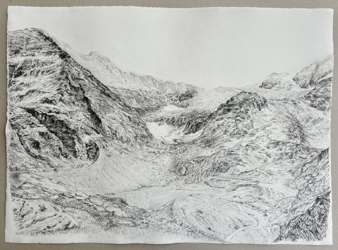
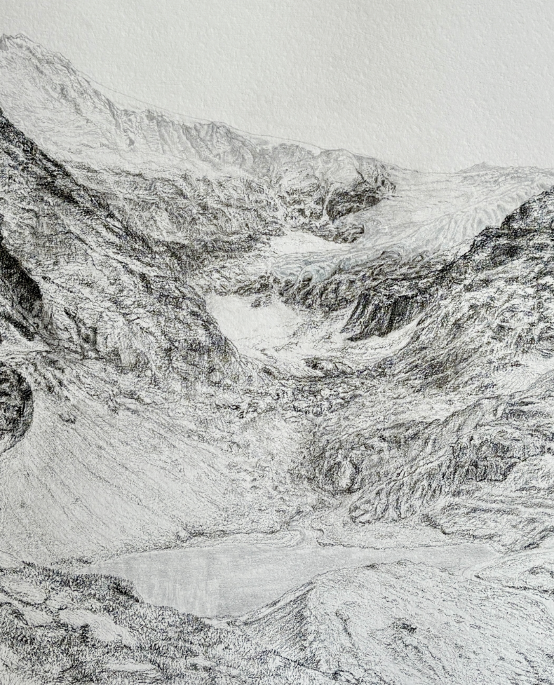
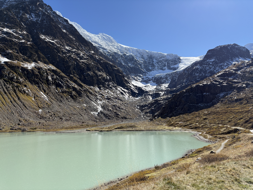
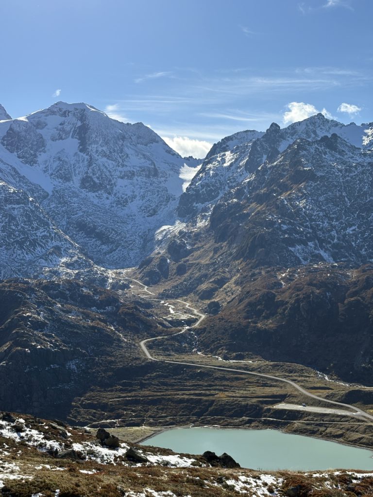
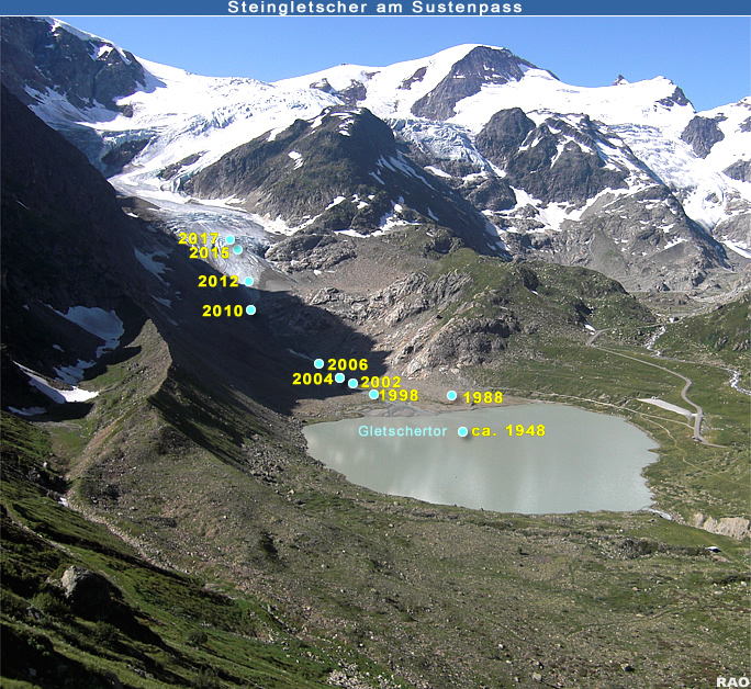
I started to investigate the glaciers we’d came across during our hikes. Looking at scientific websites that documented the retreat of the glaciers was alarming. In 1988, the terminus of the Steingletscher (lit. Stone Glacier) near the Susten Pass used to reach down to the edge of the small lake, Steinsee, which you can see in my drawing. When we visited in October 2025, our attempts to reach the terminus were foiled because it was now high up near the bend where the glacier flows down from the ridge. By the end of this century, and most likely much sooner, Steingletscher will be extinct.
Honouring the glaciers through art
The Retreat (Steingletscher 7.10.2025) is the first work in what will become a series on retreating glaciers.
I decided I wanted to document the glaciers, starting with Steingletscher. I had planned to collect some Steingletscher’s ice but the glacier was inaccessible from the valley floor and the trails on our hiking map stopped way short of where the glacier terminus now is. Instead, I collected some glacier meltwater to use in my artwork. By washing the surface of the paper with the meltwater, I have left a physical permanent trace of this dying glacier’s “DNA” within the fibres of the paper.
The other materials I have used in the drawing are symbolic.
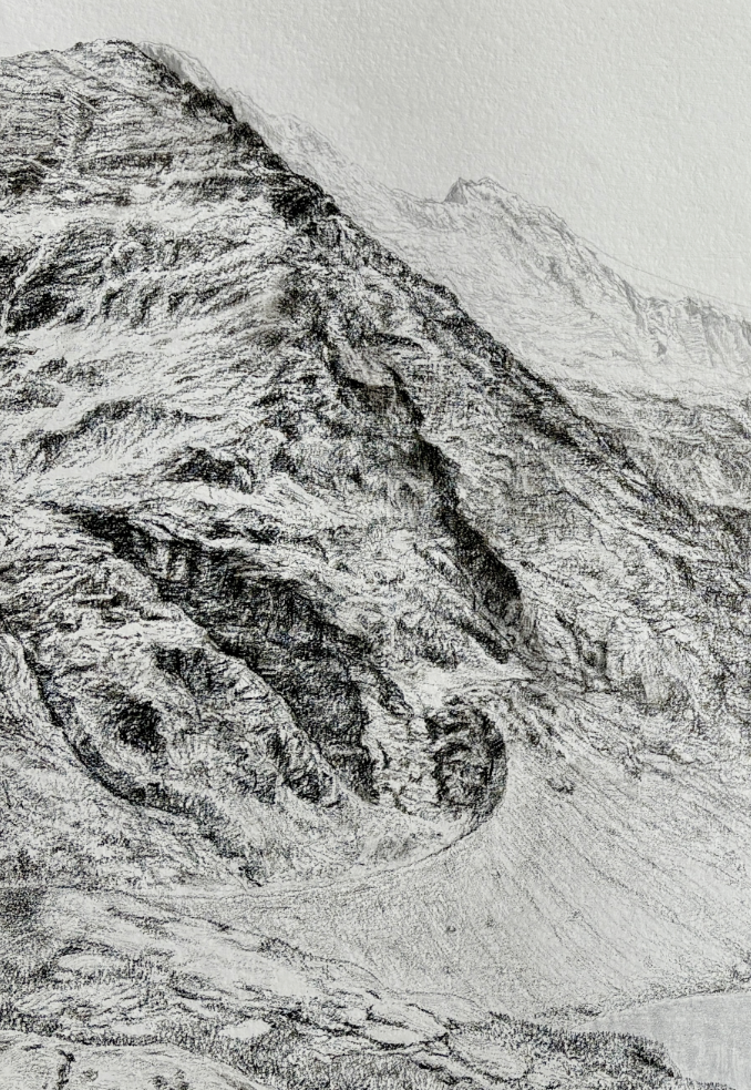
Silverpoint. The soft grey areas of the glacier and the mountain tops to the left and right, as well as Steinsee at the bottom of the valley, are done with silverpoint, ie a sterling silver stylus. It’s a drawing material that was used widely during the Renaissance before it was replaced by lead and then eventually graphite. Symbolically, the silver represents the highly reflective quality of glaciers; the reflection of sunlight combined with their sheer thermal mass helps keep the earth cool. Silver is naturally one of the most reflective metals, as well as being a precious metal widely used in jewellery, coins, electronics and solar panels. My silver marks will oxidise over time, so these glacial areas will prophetically darken to a warm brownish-grey.
Carbon. The majority of the drawing is carbon pencil, a mix of ground charcoal and binding medium pressed into a pencil – much easier, finer and more precise than using normal charcoal. Excess carbon in the environment and the unabated consumption of fossil fuels (all carbon-based) are at the root of the glacial retreat problem.
Watercolour. I coloured the glacier in a very pale blue watercolour, the water used being the same Steingletscher glacier melt water I washed the paper in.
Paper. The paper is 400 gsm hand-made rag paper, courtesy of my amazing colleagues at the Basler Papiermühle. This link to traditional manufacturing reminds us to our essential connection to and reliance on nature to survive. This ancient mill is still powered by a water wheel.
The environ.
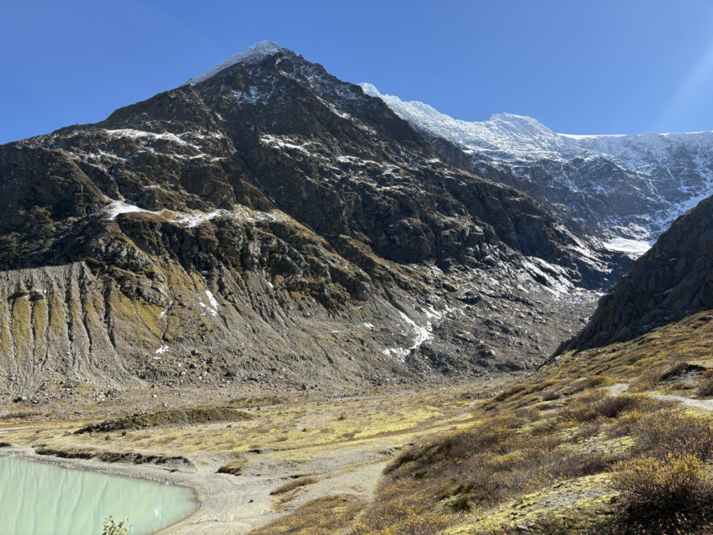
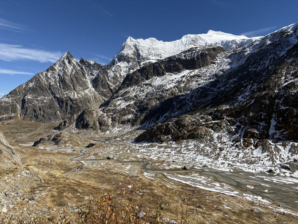
The view is from high above the valley on the Sustenpass road. The angle of view in my drawing is very wide and covers a large horizontal distance. It’s hard to appreciate the scale of the space until you’re actually standing in it. Those mountains are massive!! We walked along the right hand edge of the lake to the mouth of the stream, then along the valley floor, thinking we could follow the stream up to the glacier terminus. Ahh, the folly of the blissfully ignorant!! There were lots of little streamlets that criss-crossed; some we could jump over but others were too wide. They weren’t deep – knee-deep at most – but we didn’t want to get wet boots. The valley walls were too steep to climb up without gear, so we only ended up advancing perhaps 300 metres at the most into the valley from the lake. This glacier was not going to give up her remaining secrets that easily.
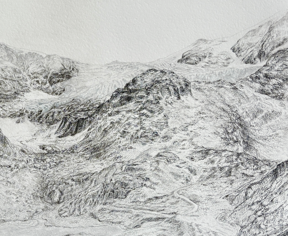
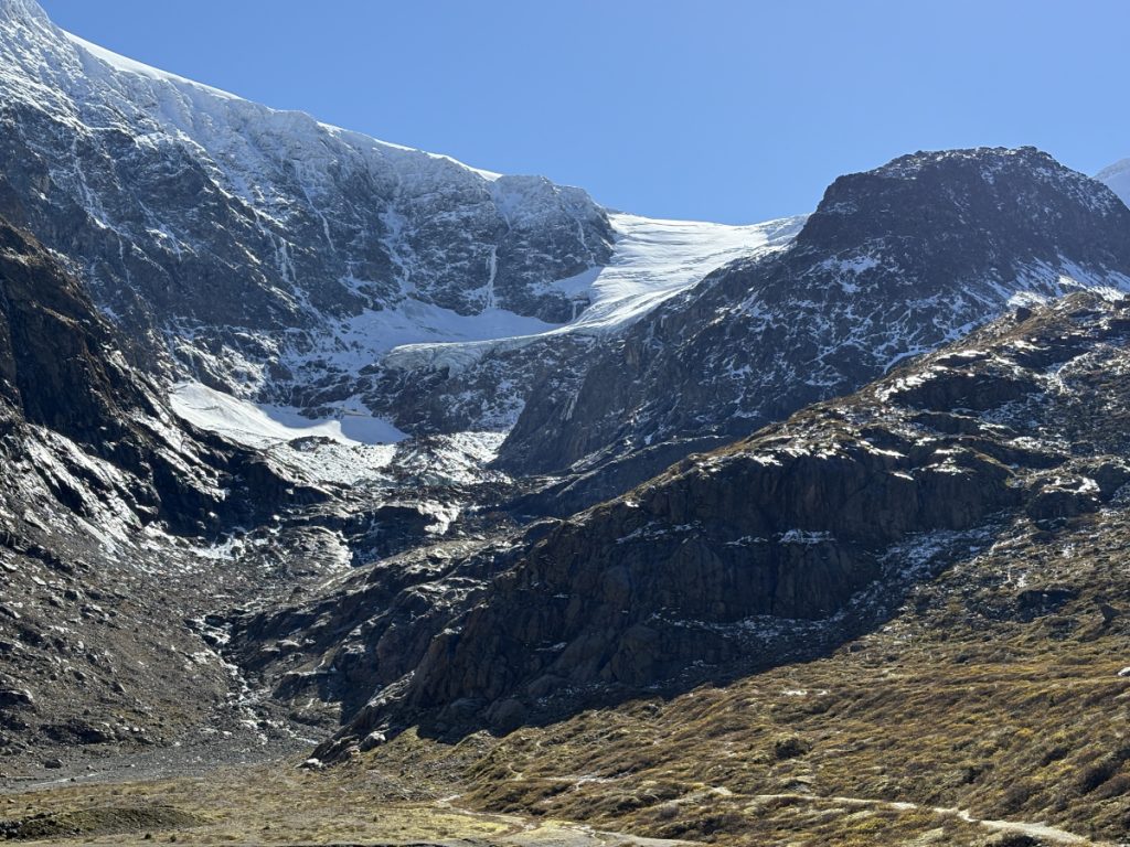
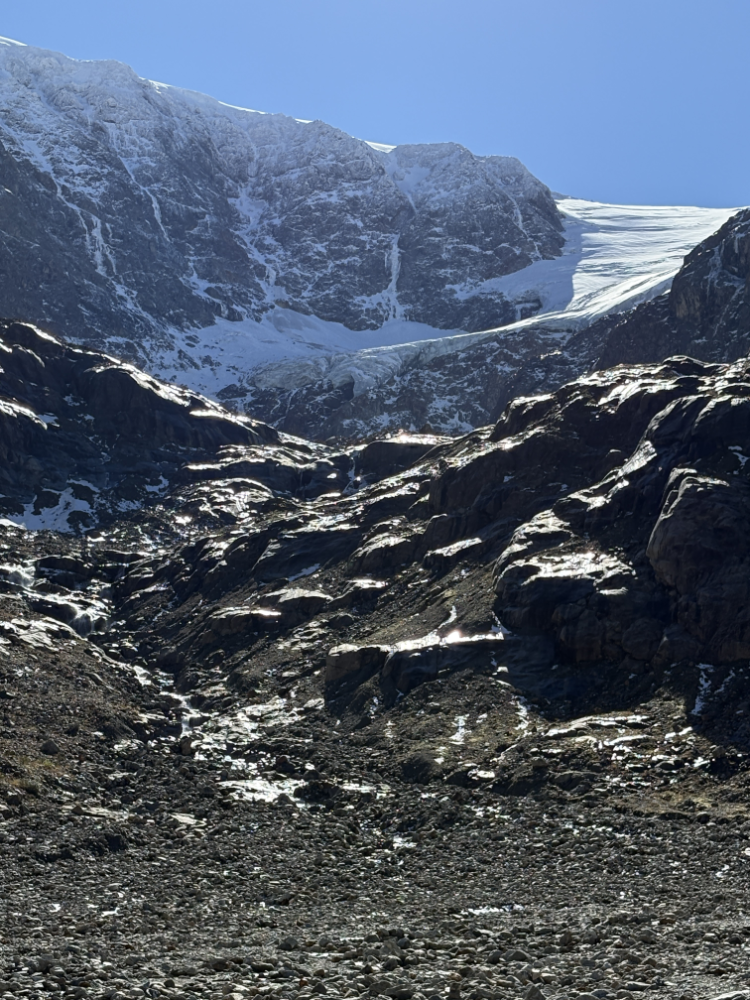
The terminus of the glacier is visible just above the large snow field in the middle of the drawing. You can see its crevices and ridges as you follow its flow up to the right where it joins with the rest of the glacier coming down from the left from the Susten Horn (far left) and off to the right.
The “footpath” you see is a single lane road that winds off to the right behind the smaller mountains in the middle ground. We drove down it to see if we could get to the offshoot of the glacier that runs down into the neighbouring valley to the right (not in view). But again, we couldn’t hike far enough up the mountain; the hiking tracks stopped abruptly and were not mountaineers. The way forward was along narrow rocky ridges and across scree, we had no ropes or gear, and it was far too dangerous for us to continue. Foiled again.
Had we had a mountain guide, there is a possible back way to the glacier via the road, then you hike up the mountains in the middle of the drawing and walk along the ridge above the valley to the glacier. But I’m not sure how accessible it really is anymore; it’s retreated about 1km in the past 20 years.
More information & glacier images.
This is an information rich resource on glaciers in Switzerland and other areas around the world. Photos show how quickly glaciers are retreating across the years. Link: